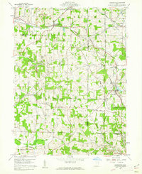
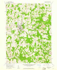
1960 Map of Kensington
USGS Topo · Published 1962About this map
The Geographers Line bisects this landscape, marking a historical surveying boundary between the Congress Lands and the Old Seven Ranges. The area is defined by a dense network of small agricultural and mining communities at the intersection of Carroll and Columbiana counties. While the Pennsylvania railroad remains a primary transit corridor through Kensington, the presence of the Pennsylvania Old Railroad Grade suggests an evolving transportation network as older lines were bypassed. Local life is anchored by family and community landmarks such as Sandy Springs Cem, Bethesda Ch, and the Township Sch. Economic activity is clearly visible through numerous Strip Mines, Oil Wells, and a Shale Pit, illustrating the region's reliance on extractive industries alongside traditional farming. Smaller hamlets like Millport, Summitville, and Dungannon are connected by a web of rural routes including Williard Road and Myers Road.
Find a feature on this map
49 named features on this map. Tap any name to fly to it.
Don’t see what you’re looking for? This feature index may not catch every label — zoom into the map to look around manually.
Map Details
Editions of this 1960 Kensington Map
Other maps of this area

1905 · Salineville
USGS Topo · 1:62,500

1909 · Alliance
USGS Topo · 1:62,500

1909 · Lisbon
USGS Topo · 1:62,500

1910 · Carrollton
USGS Topo · 1:62,500

1912 · Carrollton
USGS Topo · 1:62,500

1951 · Canton
USGS Topo · 1:250,000

1953 · Canton
USGS Topo · 1:250,000

1957 · Canton
USGS Topo · 1:250,000
1959 · Hanoverton
USGS Topo · 1:24,000
1959 · Carrollton
USGS Topo · 1:24,000