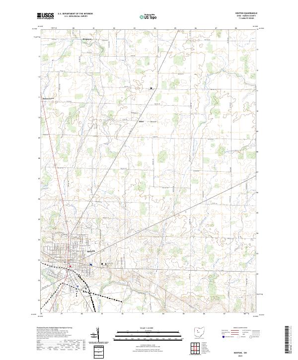
2023 Map of Kenton
USGS Topo · Published 2023About this map
Kenton serves as the focal point of this Hardin County survey, centered around the Hardin County Courthouse and a dense network of residential streets. The city sits at a geographic crossroads where the Scioto River flows through the southern outskirts, while the Blanchard River and Cessna Creek drain the northern landscape. Local heritage is preserved in several prominent burial grounds, including the large Grove Cem and Saint Marys Cem on the eastern edge of town, as well as the more remote Grant Cem to the north.
Find a feature on this map
108 named features on this map. Tap any name to fly to it.
Don’t see what you’re looking for? This feature index may not catch every label — zoom into the map to look around manually.
Map Details
Editions of this 2023 Kenton Map
This is the sole edition of this map. No revisions or reprints were ever made.
Other maps of this area

1905 · Arlington
USGS Topo · 1:62,500

1907 · Arlington
USGS Topo · 1:24,000

1907 · Upper Sandusky
USGS Topo · 1:62,500

1915 · Kenton
USGS Topo · 1:62,500

1915 · La Rue
USGS Topo · 1:62,500

1944 · Kenton
USGS Topo · 1:62,500

1950 · Marion
USGS Topo · 1:250,000

1960 · Marseilles
USGS Topo · 1:24,000
1960 · Silver Creek
USGS Topo · 1:24,000
1961 · Foraker
USGS Topo · 1:24,000