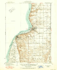
1936 Map of Keokuk
USGS Topo · Published 1951About this map
The Keokuk Dam and the waters of Keokuk Lake dominate this mid-century view of the river border between Illinois, Iowa, and Missouri. This area of Hancock County, Illinois, shows a dense network of early rural education and faith, with dozens of local institutions such as Sanobia Ch, Salem Ch, and schools like Harmony Sch and Froggy Sch serving the farming communities of Montebello and Wythe townships.
Find a feature on this map
70 named features on this map. Tap any name to fly to it.
Don’t see what you’re looking for? This feature index may not catch every label — zoom into the map to look around manually.
Map Details
Editions of this 1936 Keokuk Map
3 editions found
Other maps of this area

1903 · Kahoka
USGS Topo · 1:125,000

1932 · Lomax
USGS Topo · 1:62,500

1933 · Carthage
USGS Topo · 1:62,500

1936 · Keokuk
USGS Topo · 1:62,500

1936 · Fort Madison
USGS Topo · 1:62,500

1937 · Carthage
USGS Topo · 1:62,500

1937 · Lomax
USGS Topo · 1:62,500

1946 · Mendon
USGS Topo · 1:62,500

1948 · Mendon
USGS Topo · 1:62,500

1948 · Camp Point
USGS Topo · 1:62,500