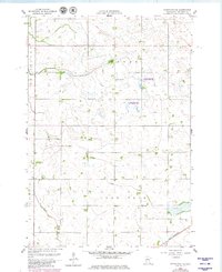
1958 Map of Kerkhoven SE
USGS Topo · Published 1980About this map
Hawk Creek meanders through the central and southern portions of this Chippewa County landscape, a terrain defined by the rural townships of Louriston, Woods, and Lone Tree. The map captures a high-water mark for mid-century rural infrastructure, showing School No 317 and a local Town Hall situated among a network of section-line roads. This survey, updated with 1970s aerial revisions, provides a clear view of the agricultural and conservation footprint in the region, including multiple tracts designated as State Wildlife Management Area. To the southeast, the Great Northern railroad cuts across the corner of the quadrangle near the Sacred Heart Cem, marking the primary transportation artery for the local grain and produce economy before the consolidation of rail lines.
Find a feature on this map
11 named features on this map. Tap any name to fly to it.
Don’t see what you’re looking for? This feature index may not catch every label — zoom into the map to look around manually.
Map Details
Editions of this 1958 Kerkhoven SE Map
3 editions found
Other maps of this area

1953 · New Ulm
USGS Topo · 1:250,000

1953 · Saint Cloud
USGS Topo · 1:250,000

1957 · Saint Cloud
USGS Topo · 1:250,000

1957 · New Ulm
USGS Topo · 1:250,000

1958 · New Ulm
USGS Topo · 1:250,000

1958 · Saint Cloud
USGS Topo · 1:250,000

1958 · Murdock
USGS Topo · 1:24,000

1958 · Kerkhoven SE
USGS Topo · 1:24,000

1958 · Kerkhoven
USGS Topo · 1:24,000

1958 · Kerkhoven SW
USGS Topo · 1:24,000