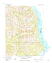
1955 Map of Ketchikan B-1
USGS Topo · Published 1974About this map
The Portland Canal serves as the dominant geographical and political boundary on this coastal survey, marking the international line between British Columbia, Alaska and Canada and the United States. The landscape is defined by the steep ascents of the Rousseau Range and the Peabody Mountains, which fall sharply into deep saltwater inlets. Within the protected reaches of the Tongass National Forest, the map records several remote maritime landmarks such as Tombstone Bay and Maple Bay. Navigation and coastal access are signaled by numerous named points, including Camp Point and Swamp Pt, which trace the treacherous shoreline leading toward the interior. The elevation peaks at Dome Peak, providing a clear sense of the vertical scale of this maritime wilderness before the expansion of modern infrastructure.
Find a feature on this map
23 named features on this map. Tap any name to fly to it.
Don’t see what you’re looking for? This feature index may not catch every label — zoom into the map to look around manually.
Map Details
Editions of this 1955 Ketchikan B-1 Map
3 editions found
Other maps of this area

1952 · Ketchikan
USGS Topo · 1:250,000

1955 · Ketchikan A-2
USGS Topo · 1:63,360

1955 · Ketchikan A-1
USGS Topo · 1:63,360

1955 · Ketchikan C-2
USGS Topo · 1:63,360

1955 · Ketchikan B-2
USGS Topo · 1:63,360

1955 · Ketchikan B-1
USGS Topo · 1:63,360

1955 · Ketchikan C-1
USGS Topo · 1:63,360

1955 · Ketchikan
USGS Topo · 1:250,000

1996 · Ketchikan C-2
USGS Topo · 1:63,360
2018 · Ketchikan B-1 NE
USGS Topo · 1:25,000