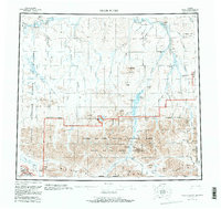
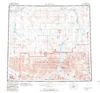
1956 Map of Killik River
USGS Topo · Published 1983About this map
The Brooks Range and the Continental Divide anchor the southern reaches of this vast northern landscape, where the Killik River and its many tributaries carve through the Arctic terrain. This 1950s survey, updated in the early 1980s, documents the transition of these lands into federal protections such as Gates of the Arctic National Park and the Gates of the Arctic Wilderness. The map reveals a land defined by its water systems, including the Colville River and significant high-latitude lakes like Kurupa Lake and Imiaknikpak Lake.
Find a feature on this map
62 named features on this map. Tap any name to fly to it.
Don’t see what you’re looking for? This feature index may not catch every label — zoom into the map to look around manually.
Map Details
Editions of this 1956 Killik River Map
6 editions found

Other maps of this area

1951 · Lookout Ridge
USGS Topo · 1:250,000

1951 · Ikpikpuk River
USGS Topo · 1:250,000

1951 · Survey Pass
USGS Topo · 1:250,000

1951 · Chandler Lake
USGS Topo · 1:250,000

1951 · Howard Pass
USGS Topo · 1:250,000

1951 · Ambler River
USGS Topo · 1:250,000

1951 · Killik River
USGS Topo · 1:250,000

1951 · Wiseman
USGS Topo · 1:250,000

1952 · Umiat
USGS Topo · 1:250,000

1955 · Umiat A-5
USGS Topo · 1:63,360