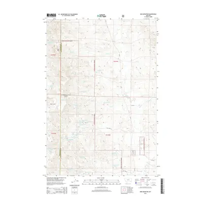
2014 Map of King Mountain
USGS Topo · Published 2014About this map
King Mtn stands as a prominent topographical feature within the Custer National Forest, marking the high ground along the border of Rosebud and Powder River Counties. This landscape is defined by an extensive network of artificial water management, evidenced by numerous named reservoirs including Paget Reservoir Number One, Chromo Reservoir, and Newell Cr Reservoir. These features, coupled with various natural water sources like Gene Creek Spring and Badget Spring, underscore the critical importance of water storage in this section of Montana. Transportation through this terrain relies on a system of forest and local roads such as MT 484 and Bryan Creek Rd, which navigate the drainages of Otter Cr and Chromo Cr. The map details the precise township and range boundaries of T4S and T5S, providing a clear view of land divisions within the national forest and surrounding ranching or grazing lands.
Find a feature on this map
41 named features on this map. Tap any name to fly to it.
Don’t see what you’re looking for? This feature index may not catch every label — zoom into the map to look around manually.
Map Details
Editions of this 2014 King Mountain Map
This is the sole edition of this map. No revisions or reprints were ever made.
Other maps of this area

1954 · Hardin
USGS Topo · 1:250,000

1957 · Hardin
USGS Topo · 1:250,000

1958 · Hardin
USGS Topo · 1:250,000

1966 · Goodspeed Butte
USGS Topo · 1:24,000

1966 · Coleman Draw
USGS Topo · 1:24,000

1966 · Ashland
USGS Topo · 1:24,000

1966 · Poker Jim Butte
USGS Topo · 1:24,000

1966 · Fort Howes
USGS Topo · 1:24,000

1966 · King Mountain
USGS Topo · 1:24,000

1966 · Willow Crossing
USGS Topo · 1:24,000