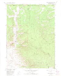
1950 Map of Kings Canyon
USGS Topo · Published 1975About this map
Medicine Bow National Forest and Roosevelt National Forest meet in this high-altitude landscape along the Colorado and Wyoming border. The 1950 field check reveals a region defined by extraction and remote encampments, with industrial sites like the Village Belle Mine and the Kings Canyon Mine marking the mountain slopes. These mining operations were supported by the presence of the Union Pacific railroad, which cuts through the western edge of the quadrangle near Camp and Clayton.
Find a feature on this map
36 named features on this map. Tap any name to fly to it.
Don’t see what you’re looking for? This feature index may not catch every label — zoom into the map to look around manually.
Map Details
Editions of this 1950 Kings Canyon Map
4 editions found
Other maps of this area

1906 · Medicine Bow
USGS Topo · 1:125,000

1908 · Medicine Bow
USGS Topo · 1:125,000

1950 · Northgate
USGS Topo · 1:24,000

1950 · Kings Canyon
USGS Topo · 1:24,000

1952 · Northgate
USGS Topo · 1:24,000

1952 · Kings Canyon
USGS Topo · 1:24,000

1954 · Rawlins
USGS Topo · 1:250,000

1954 · Craig
USGS Topo · 1:250,000

1955 · Old Roach
USGS Topo · 1:24,000

1955 · Eagle Hill
USGS Topo · 1:24,000