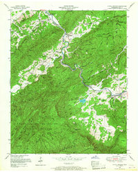
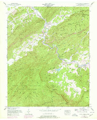
1953 Map of Kinzel Springs
USGS Topo · Published 1968About this map
Little River carves a deep valley through the Appalachian landscape, anchoring the settlements of Walland, Kinzel Springs, and Townsend during this early 1950s revision. The map illustrates a rural society organized around sheltered coves and mountain gaps, with the Great Smoky Mountains National Park boundary encompassing much of the southern high ground. Family and community life is centered at sites like Rocky Branch Church, Tuckaleechee Chapel, and the Rocky Branch School, while the rugged terrain is defined by Chilhowee Mountain and Rich Mountain. Local industry and infrastructure are represented by a Quarry near Laurel Lake and the various bench marks tracing the river's path. From the depths of Bull Cave to the height of Cerulean Knob, the topographic detail captures the transition from settled coves like Hesse Cove to the protected wilderness of the national park.
Find a feature on this map
104 named features on this map. Tap any name to fly to it.
Don’t see what you’re looking for? This feature index may not catch every label — zoom into the map to look around manually.
Map Details
Editions of this 1953 Kinzel Springs Map
5 editions found
Other maps of this area

1886 · Knoxville
USGS Topo · 1:125,000

1892 · Knoxville
USGS Topo · 1:125,000

1894 · Knoxville
USGS Topo · 1:125,000

1895 · Knoxville
USGS Topo · 1:125,000

1901 · Knoxville
USGS Topo · 1:125,000

1935 · Knoxville
USGS Topo · 1:48,000

1935 · Walden Creek
USGS Topo · 1:24,000

1935 · Maryville
USGS Topo · 1:24,000

1935 · Wildwood
USGS Topo · 1:24,000

1935 · Calderwood
USGS Topo · 1:24,000