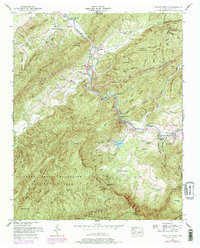
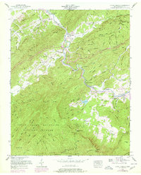
1953 Map of Kinzel Springs
USGS Topo · Published 1978About this map
Little River winds through the heart of this Blount County landscape, marking the transition from the agricultural lowlands of Miller Cove and Tuckaleechee Cove into the protected heights of the Great Smoky Mountains National Park. The map documents a mid-century community structure defined by local gathering places, such as the Rocky Branch School and numerous country churches including Millers Cove Church and Tuckaleechee Chapel.
Find a feature on this map
98 named features on this map. Tap any name to fly to it.
Don’t see what you’re looking for? This feature index may not catch every label — zoom into the map to look around manually.
Map Details
Editions of this 1953 Kinzel Springs Map
5 editions found
Other maps of this area

1886 · Knoxville
USGS Topo · 1:125,000

1892 · Knoxville
USGS Topo · 1:125,000

1894 · Knoxville
USGS Topo · 1:125,000

1895 · Knoxville
USGS Topo · 1:125,000

1901 · Knoxville
USGS Topo · 1:125,000

1935 · Knoxville
USGS Topo · 1:48,000

1935 · Walden Creek
USGS Topo · 1:24,000

1935 · Maryville
USGS Topo · 1:24,000

1935 · Wildwood
USGS Topo · 1:24,000

1935 · Calderwood
USGS Topo · 1:24,000