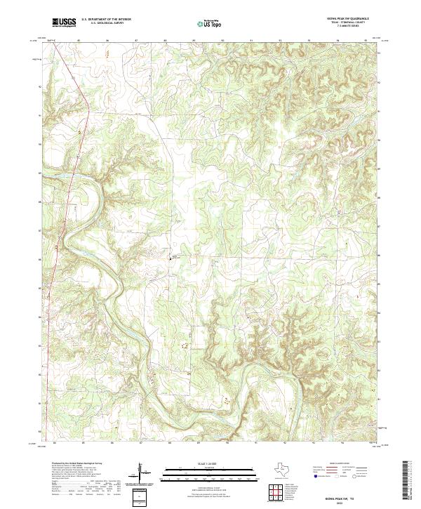
2022 Map of Kiowa Peak SW
USGS Topo · Published 2022About this map
The Salt Fork Brazos River winds through this portion of Stonewall County, carving a distinct path through the West Texas landscape. This 2022 survey captures a rural area defined by its drainage systems, including Stinking Cr and Wedington Cr, which feed into the larger river basin. Human presence is concentrated along a network of ranch-to-market roads and county routes, such as FM 1263 and C R 221, which connect the isolated homesteads and pastures characteristic of the region.
Find a feature on this map
15 named features on this map. Tap any name to fly to it.
Don’t see what you’re looking for? This feature index may not catch every label — zoom into the map to look around manually.
Map Details
Editions of this 2022 Kiowa Peak SW Map
This is the sole edition of this map. No revisions or reprints were ever made.
Other maps of this area

1925 · Aspermont 4-a
USGS Topo · 1:48,000

1931 · Aspermont
USGS Topo · 1:62,500

1954 · Lubbock
USGS Topo · 1:250,000

1958 · Lovers Resort
USGS Topo · 1:24,000

1959 · Bob Creek
USGS Topo · 1:24,000

1962 · Kiowa Peak
USGS Topo · 1:24,000

1967 · Kiowa Peak NW
USGS Topo · 1:24,000

1967 · Kiowa Peak NE
USGS Topo · 1:24,000

1967 · Kiowa Peak SW
USGS Topo · 1:24,000
1968 · Aspermont
USGS Topo · 1:24,000