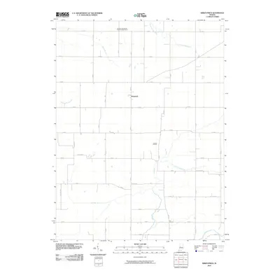
2010 Map of Kirkpatrick
USGS Topo · Published 2010About this map
Kirkpatrick serves as the central hub for this agricultural portion of Montgomery County, where the landscape is defined by a dense network of water management features and rural infrastructure. The northern reaches include the Purdue University Experimental Farm, an indication of the region's long-standing connection to agricultural science and education. Waterways such as the East Branch Wea Creek and Little Potato Creek meander through the prairie, often supplemented by man-made drainage systems like the Stock Farm Ditch and Romney Fraley Ditch. These ditches reflect the effort to reclaim and manage the rich Indiana soil for large-scale farming. For those tracing family histories, local heritage is preserved at the Peterson Cemetery and Rice Cemetery, both established within the grid of section roads that crisscross the countryside. The map documents a classic Midwestern rural layout where development remains concentrated around established family-named landmarks and historical burial grounds.
Find a feature on this map
42 named features on this map. Tap any name to fly to it.
Don’t see what you’re looking for? This feature index may not catch every label — zoom into the map to look around manually.
Map Details
Editions of this 2010 Kirkpatrick Map
This is the sole edition of this map. No revisions or reprints were ever made.
Other maps of this area

1953 · Danville
USGS Topo · 1:250,000

1955 · Danville
USGS Topo · 1:250,000

1956 · Danville
USGS Topo · 1:250,000

1956 · Crawfordsville
USGS Topo · 1:24,000

1958 · Darlington
USGS Topo · 1:24,000

1958 · Linden
USGS Topo · 1:24,000

1958 · Kirkpatrick
USGS Topo · 1:24,000

1961 · Mulberry
USGS Topo · 1:24,000

1961 · Romney
USGS Topo · 1:24,000

1961 · Stockwell
USGS Topo · 1:24,000