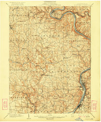
1902 Map of Kittanning
USGS Topo · Published 1922About this map
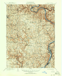
Bradys Bend anchors the northern reaches of this western Pennsylvania landscape, where the Allegheny River carves a dramatic oxbow through the coal and iron country of Armstrong, Butler, and Clarion counties. At the turn of the century, the river valley served as a critical industrial corridor, hosting the Pennsylvania RR and the Pittsburgh and Allegheny Valley RR. These rail lines connected established manufacturing centers like Kittanning and Wickboro to northern outposts such as East Brady and Phillipston.
Find a feature on this map
79 named features on this map. Tap any name to fly to it.
Don’t see what you’re looking for? This feature index may not catch every label — zoom into the map to look around manually.
Map Details
Editions of this 1902 Kittanning Map
6 editions found
Other maps of this area

1900 · Kittanning
USGS Topo · 1:62,500

1901 · Rural Valley
USGS Topo · 1:62,500

1902 · Kittanning
USGS Topo · 1:62,500

1902 · Elders Ridge
USGS Topo · 1:62,500

1903 · Rural Valley
USGS Topo · 1:62,500

1904 · Elders Ridge
USGS Topo · 1:62,500

1906 · Clarion
USGS Topo · 1:62,500

1907 · Clarion
USGS Topo · 1:62,500

1907 · Foxburg
USGS Topo · 1:62,500

1907 · Freeport
USGS Topo · 1:62,500