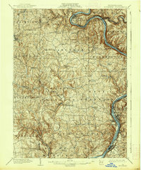
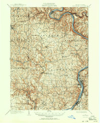
1902 Map of Kittanning
USGS Topo · Published 1938About this map
The Allegheny River carves a deep, sinuous path through this 1900 survey of Armstrong and Butler Counties, dictating the placement of early industrial hubs and transport lines. Industrial activity is prominent along the riverbanks, most notably at Redbank Furnace and within the developed street grid of Kittanning. To the west, the landscape transition into more dissected plateau country where milling operations like Buffalo Mills and Fosters Mills established local economic centers.
Find a feature on this map
71 named features on this map. Tap any name to fly to it.
Don’t see what you’re looking for? This feature index may not catch every label — zoom into the map to look around manually.
Map Details
Editions of this 1902 Kittanning Map
6 editions found
Other maps of this area

1900 · Kittanning
USGS Topo · 1:62,500

1901 · Rural Valley
USGS Topo · 1:62,500

1902 · Kittanning
USGS Topo · 1:62,500

1902 · Elders Ridge
USGS Topo · 1:62,500

1903 · Rural Valley
USGS Topo · 1:62,500

1904 · Elders Ridge
USGS Topo · 1:62,500

1906 · Clarion
USGS Topo · 1:62,500

1907 · Clarion
USGS Topo · 1:62,500

1907 · Foxburg
USGS Topo · 1:62,500

1907 · Freeport
USGS Topo · 1:62,500