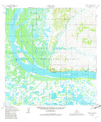
1952 Map of Kwiguk A-4
USGS Topo · Published 1983About this map
Mountain Village occupies a strategic bend in the Yukon River on this mid-century survey of the Yukon Delta. The landscape is a complex network of waterways, including the Tunurokpak Channel and Azacharum Slough, where seasonal subsistence and transportation are evidenced by Patsys Cabin and the Winter Trail. Infrastructure at the village reflects its role as a regional hub, featuring a Water Tower, a Landing Strip, and a Seaplane Anchorage along the riverfront.
Find a feature on this map
23 named features on this map. Tap any name to fly to it.
Don’t see what you’re looking for? This feature index may not catch every label — zoom into the map to look around manually.
Map Details
Editions of this 1952 Kwiguk A-4 Map
3 editions found
Other maps of this area

1951 · Marshall
USGS Topo · 1:250,000

1952 · Kwiguk
USGS Topo · 1:250,000

1952 · Kwiguk B-3
USGS Topo · 1:63,360

1952 · Kwiguk A-5
USGS Topo · 1:63,360

1952 · Kwiguk B-5
USGS Topo · 1:63,360

1952 · Kwiguk A-4
USGS Topo · 1:63,360

1952 · Kwiguk A-3
USGS Topo · 1:63,360

1952 · Kwiguk B-4
USGS Topo · 1:63,360

1952 · Marshall D-5
USGS Topo · 1:63,360

1952 · Marshall D-4
USGS Topo · 1:63,360