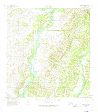
1952 Map of Kwiguk B-2
USGS Topo · Published 1973About this map
The Andreafsky River winds through the heart of this landscape, its path defined by a series of dramatic bends and meanders that characterize the remote terrain of western Alaska. Surveyed in the early 1950s using aerial photography, the sheet reveals a wilderness largely untouched by permanent settlements or roads, focusing instead on the complex drainage patterns of the river system. Along the eastern edge, the East Fork Andreafsky River joins the main stem, while Allen Creek feeds the river from the north. The absence of human development highlights the raw geography of the Kusilvak region, providing a baseline for environmental historians and researchers interested in the natural topography of the Alaskan interior before modern shifts in land management and climate.
Find a feature on this map
3 named features on this map. Tap any name to fly to it.
Don’t see what you’re looking for? This feature index may not catch every label — zoom into the map to look around manually.
Map Details
Editions of this 1952 Kwiguk B-2 Map
2 editions found
Other maps of this area

1952 · Kwiguk
USGS Topo · 1:250,000

1952 · Kwiguk B-3
USGS Topo · 1:63,360

1952 · Kwiguk B-2
USGS Topo · 1:63,360

1952 · Kwiguk C-2
USGS Topo · 1:63,360

1952 · Kwiguk C-3
USGS Topo · 1:63,360

1952 · Kwiguk A-2
USGS Topo · 1:63,360

1952 · Kwiguk A-1
USGS Topo · 1:63,360

1952 · Kwiguk B-1
USGS Topo · 1:63,360

1952 · Kwiguk A-3
USGS Topo · 1:63,360

1952 · Kwiguk C-1
USGS Topo · 1:63,360