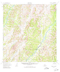
1952 Map of Kwiguk C-1
USGS Topo · Published 1980About this map
North Peak rises as a prominent landmark in this 1952 topographic study of the Alaskan interior near the Bering Sea coast. The landscape is defined by the winding course of the Andreafsky River, which dominates the western portion of the sheet. Its major tributary, the East Fork Andreafsky River, carves through the eastern terrain, illustrating the intricate drainage patterns characteristic of this subarctic environment. Mapped by the Army Map Service using photogrammetric methods from 1951 aerial photography, the map reveals a wilderness without established roads or trails at the time of the survey. The concentration of contour lines around the high points provides a clear record of the area's relief and elevation long before modern development or climate-driven changes altered the riparian systems.
Find a feature on this map
3 named features on this map. Tap any name to fly to it.
Don’t see what you’re looking for? This feature index may not catch every label — zoom into the map to look around manually.
Map Details
Editions of this 1952 Kwiguk C-1 Map
4 editions found
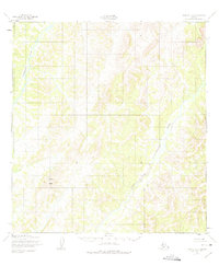
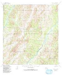
Other maps of this area

1951 · Holy Cross
USGS Topo · 1:250,000

1952 · Kwiguk
USGS Topo · 1:250,000

1952 · Kwiguk D-1
USGS Topo · 1:63,360

1952 · Kwiguk B-2
USGS Topo · 1:63,360

1952 · Kwiguk C-2
USGS Topo · 1:63,360

1952 · Kwiguk D-2
USGS Topo · 1:63,360

1952 · Holy Cross C-6
USGS Topo · 1:63,360

1952 · Holy Cross B-6
USGS Topo · 1:63,360

1952 · Kwiguk B-1
USGS Topo · 1:63,360

1952 · Kwiguk C-1
USGS Topo · 1:63,360