
1952 Map of Kwiguk C-4
USGS Topo · Published 1959About this map
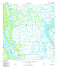
Kwikpak Pass and the Yukon River dominate this 1952 topographic study of the Alaska delta region, revealing a landscape defined by shifting waterways and seasonal routes. Small settlements and temporary encampments like New Hamilton, Fish Village, and Kwikpuk are positioned along the major channels, highlighting the area's dependence on the river system for transport and subsistence. The intricate network of smaller braids, including Nanvaranak Slough and Orfauchakuk Slough, illustrates the complex hydrologic character of the tundra before more modern infrastructure arrived. A notable Winter Trail cuts across the wetlands, marking the vital cold-weather connections between remote Cabins and larger river outposts during the early fifties.
Find a feature on this map
9 named features on this map. Tap any name to fly to it.
Don’t see what you’re looking for? This feature index may not catch every label — zoom into the map to look around manually.
Map Details
Editions of this 1952 Kwiguk C-4 Map
2 editions found
Other maps of this area

1952 · Kwiguk
USGS Topo · 1:250,000

1952 · Kwiguk B-3
USGS Topo · 1:63,360

1952 · Kwiguk D-3
USGS Topo · 1:63,360

1952 · Kwiguk C-3
USGS Topo · 1:63,360

1952 · Kwiguk B-5
USGS Topo · 1:63,360

1952 · Kwiguk C-5
USGS Topo · 1:63,360

1952 · Kwiguk D-5
USGS Topo · 1:63,360

1952 · Kwiguk B-4
USGS Topo · 1:63,360

1952 · Kwiguk D-4
USGS Topo · 1:63,360
2020 · Kwiguk B-3 NW
USGS Topo · 1:25,000