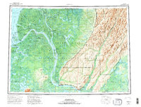
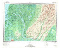
1952 Map of Kwiguk
USGS Topo · Published 1996About this map
The Yukon River divides into a complex web of distributaries as it nears the Bering Sea, defining the subsistence landscape of the Yukon Delta National Wildlife Refuge during the early 1950s. This survey records numerous indigenous and river settlements at a time when the waterways served as the primary thoroughfares. Notable locations like Emmonak, Kwiguk, and Alakanuk sit along the Kwikluak Pass, while further upstream, Mountain Village and Johnnys Village occupy the firm ground near the Andreafsky Hills.
Find a feature on this map
68 named features on this map. Tap any name to fly to it.
Don’t see what you’re looking for? This feature index may not catch every label — zoom into the map to look around manually.
Map Details
Editions of this 1952 Kwiguk Map
8 editions found
Other maps of this area

1947 · Russian Mission
USGS Topo · 1:250,000

1950 · Russian Mission
USGS Topo · 1:250,000

1951 · Marshall
USGS Topo · 1:250,000

1951 · Unalakleet
USGS Topo · 1:250,000

1951 · Hooper Bay
USGS Topo · 1:250,000

1951 · Black
USGS Topo · 1:250,000

1951 · St Michael
USGS Topo · 1:250,000

1951 · Holy Cross
USGS Topo · 1:250,000

1952 · Kwiguk
USGS Topo · 1:250,000

1952 · Kwiguk D-1
USGS Topo · 1:63,360