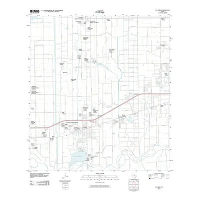
2010 Map of La Feria
USGS Topo · Published 2010About this map
La Feria and the surrounding irrigation districts of the Rio Grande Valley appear here during a period of significant residential expansion. The landscape is defined by an intricate network of drainage and supply channels, such as the Wilson Canal and the Cameron Company Levee, which manage water for both agricultural and municipal use. Numerous colonias and family-named settlements dot the grid, including the O'Canas Family Colonia and Aurora Longoria Colonia, reflecting the region's unique heritage and growth patterns.
Find a feature on this map
113 named features on this map. Tap any name to fly to it.
Don’t see what you’re looking for? This feature index may not catch every label — zoom into the map to look around manually.
Map Details
Editions of this 2010 La Feria Map
This is the sole edition of this map. No revisions or reprints were ever made.
Other maps of this area

1929 · Harlingen
USGS Topo · 1:24,000

1929 · Santa Rosa
USGS Topo · 1:24,000

1929 · Santa Maria
USGS Topo · 1:24,000

1929 · La Feria
USGS Topo · 1:24,000

1929 · La Paloma
USGS Topo · 1:24,000

1932 · Combes
USGS Topo · 1:31,680

1932 · Harlingen
USGS Topo · 1:31,680

1933 · Santa Rosa
USGS Topo · 1:31,680

1936 · La Feria
USGS Topo · 1:31,680

1936 · Santa Maria
USGS Topo · 1:31,680