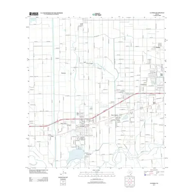
2013 Map of La Feria
USGS Topo · Published 2013About this map
La Feria serves as the central hub of this Lower Rio Grande Valley landscape, where an intricate network of irrigation channels like the Evans Canal and Wilson Canal supports the region's agricultural character. The terrain is defined by the winding course of the Arroyo Colorado along the southern edge and significant water storage features including the La Feria Reservoir and Valley Acres Reservoir. Residential growth is evident in settlements such as Primera, Grand Acres, and Adams Gardens, while local history is preserved at the San Francisco Cemeteries and Restlawn Memorial Park. A unique aviation landmark, the Old Reb Airport, sits west of the main town center. The map captures the transition from historic lake beds, such as the Tiocano Lake Bed, into a highly engineered environment of citrus groves and homesteads characteristic of Cameron County's modern development.
Find a feature on this map
58 named features on this map. Tap any name to fly to it.
Don’t see what you’re looking for? This feature index may not catch every label — zoom into the map to look around manually.
Map Details
Editions of this 2013 La Feria Map
This is the sole edition of this map. No revisions or reprints were ever made.
Other maps of this area

1929 · Harlingen
USGS Topo · 1:24,000

1929 · Santa Rosa
USGS Topo · 1:24,000

1929 · Santa Maria
USGS Topo · 1:24,000

1929 · La Feria
USGS Topo · 1:24,000

1929 · La Paloma
USGS Topo · 1:24,000

1932 · Combes
USGS Topo · 1:31,680

1932 · Harlingen
USGS Topo · 1:31,680

1933 · Santa Rosa
USGS Topo · 1:31,680

1936 · La Feria
USGS Topo · 1:31,680

1936 · Santa Maria
USGS Topo · 1:31,680