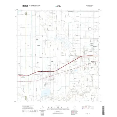
2019 Map of La Feria
USGS Topo · Published 2019About this map
The winding Arroyo Colorado anchors the southern landscape of this Rio Grande Valley region, defining the agricultural and residential layout of Hidalgo Co Cameron Co. The corridor along Highway 83 serves as a primary axis of development, connecting the city of La Feria with its northern extensions, La Feria North and Solis Colonia. This 2019 survey documents a complex network of irrigation infrastructure essential to the local citrus and vegetable economy, including the Evans Canal, Wilson Canal, and the La Feria Reservoir. To the east, the edge of Harlingen and the distinct community of Palm Valley emerge, while the northern reaches transition into the rural plots surrounding Santa Rosa and Grand Acres. Genealogists may find interest in the San Francisco Cemeteries and Restlawn Memorial Park, which serve these long-established agricultural communities.
Find a feature on this map
188 named features on this map. Tap any name to fly to it.
Don’t see what you’re looking for? This feature index may not catch every label — zoom into the map to look around manually.
Map Details
Editions of this 2019 La Feria Map
This is the sole edition of this map. No revisions or reprints were ever made.
Other maps of this area

1929 · Harlingen
USGS Topo · 1:24,000

1929 · Santa Rosa
USGS Topo · 1:24,000

1929 · Santa Maria
USGS Topo · 1:24,000

1929 · La Feria
USGS Topo · 1:24,000

1929 · La Paloma
USGS Topo · 1:24,000

1932 · Combes
USGS Topo · 1:31,680

1932 · Harlingen
USGS Topo · 1:31,680

1933 · Santa Rosa
USGS Topo · 1:31,680

1936 · La Feria
USGS Topo · 1:31,680

1936 · Santa Maria
USGS Topo · 1:31,680