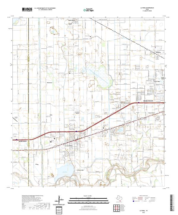
2022 Map of La Feria
USGS Topo · Published 2022About this map
The Arroyo Colorado winds along the southern edge of this Cameron County landscape, a region defined by its extensive network of irrigation infrastructure including the Wilson Canal and Evans Canal. The city of La Feria serves as a central hub, surrounded by smaller communities and agricultural developments such as Solis, Ratamosa, and Bixby. The presence of numerous family-named and community burial grounds, such as Hinojosa Cem and La Capilla Cem, provides significant points of interest for genealogists tracing local heritage. Toward the north, the Tiocano Lake Bed and La Feria Reservoir illustrate the area's hydrological management. Notable aviation history is represented by the Old Reb Airport, while modern residential growth is evident in the planned streets of Palm Valley and the outskirts of Harlingen.
Find a feature on this map
115 named features on this map. Tap any name to fly to it.
Don’t see what you’re looking for? This feature index may not catch every label — zoom into the map to look around manually.
Map Details
Editions of this 2022 La Feria Map
This is the sole edition of this map. No revisions or reprints were ever made.
Other maps of this area

1929 · Harlingen
USGS Topo · 1:24,000

1929 · Santa Rosa
USGS Topo · 1:24,000

1929 · Santa Maria
USGS Topo · 1:24,000

1929 · La Feria
USGS Topo · 1:24,000

1929 · La Paloma
USGS Topo · 1:24,000

1932 · Combes
USGS Topo · 1:31,680

1932 · Harlingen
USGS Topo · 1:31,680

1933 · Santa Rosa
USGS Topo · 1:31,680

1936 · La Feria
USGS Topo · 1:31,680

1936 · Santa Maria
USGS Topo · 1:31,680