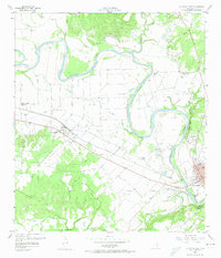
1958 Map of La Grange West
USGS Topo · Published 1974About this map
The Colorado River meanders through Fayette County, defining the agricultural and industrial landscape of this Texas region. Along its banks, the settlement of Plum sits as a key focal point, bisected by the Missouri Kansas Texas railroad line. The map illustrates a rural society organized around small crossroads and parish centers, such as Prairie Valley with its St Peters Ch and the St Jerome Sch located further south.
Find a feature on this map
55 named features on this map. Tap any name to fly to it.
Don’t see what you’re looking for? This feature index may not catch every label — zoom into the map to look around manually.
Map Details
Editions of this 1958 La Grange West Map
3 editions found

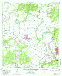
Other maps of this area

1885 · Bastrop
USGS Topo · 1:125,000

1893 · Bastrop
USGS Topo · 1:125,000

1901 · Flatonia
USGS Topo · 1:125,000

1904 · Bastrop
USGS Topo · 1:125,000

1919 · Giddings
USGS Topo · 1:62,500

1948 · Smithville
USGS Topo · 1:62,500

1950 · Smithville
USGS Topo · 1:62,500

1953 · Seguin
USGS Topo · 1:250,000

1954 · Austin
USGS Topo · 1:250,000

1956 · La Grange
USGS Topo · 1:62,500