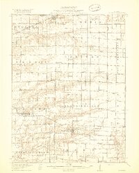
1918 Map of La Harpe
USGS Topo · Published 1918About this map
La Harpe and Blandinsville serve as primary hubs in this agricultural region where the Toledo Peoria And Western railroad facilitates the transport of local goods. The landscape is defined by the branching waterways of Crooked Creek, which feed into the South Branch and North Branch, creating a network of drainage across the rolling prairie. This era is characterized by an exceptionally dense system of rural education, with one-room schoolhouses such as Hardscrabble School, Rabbit Burrow School, and Gilead School spaced precisely at two-mile intervals to serve farming families.
Find a feature on this map
85 named features on this map. Tap any name to fly to it.
Don’t see what you’re looking for? This feature index may not catch every label — zoom into the map to look around manually.
Map Details
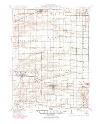
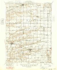
Editions of this 1918 La Harpe Map
4 editions found
Other maps of this area

1912 · Macomb
USGS Topo · 1:62,500

1913 · Colchester
USGS Topo · 1:62,500

1914 · Macomb
USGS Topo · 1:62,500

1916 · Good Hope
USGS Topo · 1:62,500

1918 · La Harpe
USGS Topo · 1:62,500

1918 · Good Hope
USGS Topo · 1:62,500

1921 · Monmouth
USGS Topo · 1:62,500

1923 · Monmouth
USGS Topo · 1:62,500

1932 · Lomax
USGS Topo · 1:62,500

1933 · Carthage
USGS Topo · 1:62,500