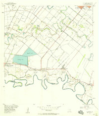
1956 Map of La Paloma
USGS Topo · Published 1958About this map
Meandering loops of the Rio Grande define the southern border of this Rio Grande Valley quadrangle, characterized by a complex system of oxbows and irrigation infrastructure. The landscape is marked by numerous 'bancos'—sections of land cut off by shifts in the river—such as Capote Banco No 13 and Benavides Banco No 10. A network of canals and elevated ditches supports the agricultural fields surrounding La Paloma, while the Old Railroad Grade traces a path through the settlements of Carricitos and Los Indios.
Find a feature on this map
40 named features on this map. Tap any name to fly to it.
Don’t see what you’re looking for? This feature index may not catch every label — zoom into the map to look around manually.
Map Details
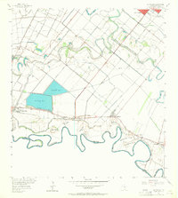
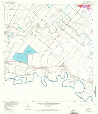
Editions of this 1956 La Paloma Map
3 editions found
Other maps of this area

1929 · Rio Hondo
USGS Topo · 1:24,000

1929 · Harlingen
USGS Topo · 1:24,000

1929 · Santa Maria
USGS Topo · 1:24,000

1929 · La Feria
USGS Topo · 1:24,000

1929 · La Paloma
USGS Topo · 1:24,000

1930 · West Brownsville
USGS Topo · 1:24,000

1930 · Barreda
USGS Topo · 1:24,000

1932 · Rio Hondo
USGS Topo · 1:31,680

1932 · Harlingen
USGS Topo · 1:31,680

1936 · La Feria
USGS Topo · 1:31,680