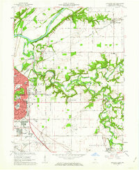
1961 Map of Lafayette East
USGS Topo · Published 1966About this map
Wildcat Creek and its major tributaries, the Middle Fork and South Fork, dominate the central and eastern landscape of this early 1960s survey. The city of Lafayette expands eastward, showing established neighborhoods like Eastwitch and Meadowbrook alongside newer commercial developments such as the Market Square Shopping Center. The era's transportation network is clearly defined by the Wabash Railroad and New York Central System crossing the terrain, while small aviation sites like Aretz Airport and Halsmer Airport serve the local community.
Find a feature on this map
69 named features on this map. Tap any name to fly to it.
Don’t see what you’re looking for? This feature index may not catch every label — zoom into the map to look around manually.
Map Details
Editions of this 1961 Lafayette East Map
5 editions found

Other maps of this area

1941 · Lafayette
USGS Topo · 1:24,000

1942 · Lafayette
USGS Topo · 1:24,000

1950 · Lafayette
USGS Topo · 1:24,000

1953 · Danville
USGS Topo · 1:250,000

1955 · Danville
USGS Topo · 1:250,000

1956 · Danville
USGS Topo · 1:250,000

1961 · Mulberry
USGS Topo · 1:24,000

1961 · Pyrmont
USGS Topo · 1:24,000

1961 · Romney
USGS Topo · 1:24,000

1961 · Stockwell
USGS Topo · 1:24,000