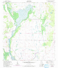
1952 Map of Lake Arbuckle SE
USGS Topo · Published 1993About this map
The Avon Park Bombing Range dominates this portion of the Florida landscape, encompassing vast stretches of wetlands and specialized training grounds. The terrain is defined by the complex movement of water through the Long Cypress Slash and into numerous isolated basins. Significant water bodies such as Submarine Lake and Bonny Bloom Pond are scattered across the range, illustrating the unique hydrology of this interior region before modern drainage alterations. Along the western edge, Arbuckle Creek serves as a primary drainage artery, fed by smaller tributaries like Morgan Hole Creek and the Arbuckle Branch. The map reflects a mid-century military landscape where the natural swampy environment was utilized for training, preserving a specific ecological state of the Highlands County backcountry.
Find a feature on this map
12 named features on this map. Tap any name to fly to it.
Don’t see what you’re looking for? This feature index may not catch every label — zoom into the map to look around manually.
Map Details
Editions of this 1952 Lake Arbuckle SE Map
4 editions found
Other maps of this area

1952 · Fort Kissimmee
USGS Topo · 1:24,000

1952 · Lake Arbuckle SW
USGS Topo · 1:24,000

1952 · Fort Kissimmee NW
USGS Topo · 1:24,000

1952 · Lake Arbuckle NE
USGS Topo · 1:24,000

1952 · Lake Arbuckle SE
USGS Topo · 1:24,000

1952 · Lake Arbuckle
USGS Topo · 1:24,000

1952 · Lorida
USGS Topo · 1:24,000

1952 · Sebring
USGS Topo · 1:24,000

1953 · Basinger NW
USGS Topo · 1:24,000

1956 · Fort Pierce
USGS Topo · 1:250,000