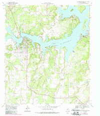
1969 Map of Lake Brownwood
USGS Topo · Published 1988About this map
Lake Brownwood dominates this 1960s landscape, featuring a complex shoreline defined by points, coves, and islands. The central portion of the map showcases the recreational development of Shamrock Shores and Lake Shore during a period of significant growth for the region. To the northeast, Lake Brownwood State Park encompasses a large peninsula, while the Brownwood Dam and an adjacent Gaging Sta mark the controlled outlet of the reservoir.
Find a feature on this map
34 named features on this map. Tap any name to fly to it.
Don’t see what you’re looking for? This feature index may not catch every label — zoom into the map to look around manually.
Map Details
Editions of this 1969 Lake Brownwood Map
3 editions found
Other maps of this area

1887 · Coleman
USGS Topo · 1:125,000

1889 · Brownwood
USGS Topo · 1:125,000

1889 · Coleman
USGS Topo · 1:125,000

1894 · Brownwood
USGS Topo · 1:125,000

1924 · Coleman 1-a
USGS Topo · 1:48,000

1924 · Brownwood Reservoir Site
USGS Topo · 1:48,000

1925 · Brownwood 3-b
USGS Topo · 1:48,000

1927 · Grosvenor
USGS Topo · 1:62,500

1928 · Zephyr
USGS Topo · 1:62,500

1950 · Zephyr
USGS Topo · 1:62,500