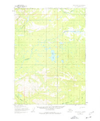
1954 Map of Lake Clark C-4
USGS Topo · Published 1977About this map
The Mulchatna River and the Chilikadrotna River dominate this interior Alaskan landscape, which was mapped from aerial photography in the late 1950s. The terrain transitions from the high peaks of the Bonanza Hills in the northwest down to a complex system of kettle lakes and wetlands in the central plateau. A significant archaeological and historical marker on this map is the long Native Trail that traverses the southern and eastern quadrants, providing a record of traditional overland travel routes through the river valleys. Water features such as Snipe Lake and the confluence of the Little Mulchatna River indicate a landscape defined by seasonal flow and remote accessibility. These unmarked locations, many predetermined by the Bureau of Land Management, reveal the state of the Alaskan wilderness before more modern infrastructure began to alter these historic corridors.
Find a feature on this map
9 named features on this map. Tap any name to fly to it.
Don’t see what you’re looking for? This feature index may not catch every label — zoom into the map to look around manually.
Map Details
Editions of this 1954 Lake Clark C-4 Map
4 editions found
Other maps of this area

1946 · Lake Clark
USGS Topo · 1:250,000

1951 · Lake Clark
USGS Topo · 1:250,000

1954 · Lake Clark C-3
USGS Topo · 1:63,360

1954 · Lake Clark C-4
USGS Topo · 1:63,360

1954 · Lake Clark D-3
USGS Topo · 1:63,360

1954 · Lake Clark B-5
USGS Topo · 1:63,360

1954 · Lake Clark B-3
USGS Topo · 1:63,360

1954 · Lake Clark D-5
USGS Topo · 1:63,360

1954 · Lake Clark C-5
USGS Topo · 1:63,360

1954 · Lake Clark B-4
USGS Topo · 1:63,360