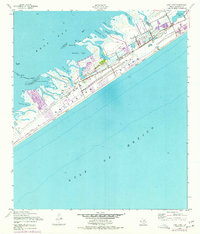
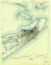
1954 Map of Lake Como
USGS Topo · Published 1977About this map
Galveston Island stretches between the Gulf of Mexico and West Bay in this mid-century look at the Texas coastline. The landscape is defined by its intricate network of inlets and tidal flats, where names like Starvation Cove and Meleger Cove suggest the long history of coastal navigation and fishing in the region. Settlement patterns in the 1950s—updated through the mid-1970s—show development clustering around Stewart Road and along the shores of Sweetwater Lake and Lake Como.
Find a feature on this map
31 named features on this map. Tap any name to fly to it.
Don’t see what you’re looking for? This feature index may not catch every label — zoom into the map to look around manually.
Map Details
Editions of this 1954 Lake Como Map
4 editions found
Other maps of this area

1929 · Karankawa Lake
USGS Topo · 1:24,000

1929 · Hitchcock
USGS Topo · 1:24,000

1929 · Virginia Point
USGS Topo · 1:24,000

1930 · Galveston
USGS Topo · 1:24,000

1931 · Lake Como
USGS Topo · 1:24,000

1932 · Hitchcock
USGS Topo · 1:31,680

1932 · Virginia Point
USGS Topo · 1:31,680

1933 · Karankawa Lake
USGS Topo · 1:31,680

1933 · San Luis Pass
USGS Topo · 1:31,680
1933 · Galveston
USGS Topo · 1:31,680