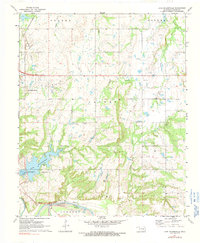
1972 Map of Lake Holdenville
USGS Topo · Published 1991About this map
The Canadian River and Little River converge in this Oklahoma landscape, defining a region where water management and energy extraction shaped the local economy. At the heart of the terrain lies Lake Holdenville, supported by the Holdenville State Fish Hatchery and several nearby springs. The map documents an active Oil Field, with numerous Oil Wells peppered across the townships of Yeager, Jacobs, and Bilby, illustrating the mid-century industrial footprint on the Hughes County countryside.
Find a feature on this map
30 named features on this map. Tap any name to fly to it.
Don’t see what you’re looking for? This feature index may not catch every label — zoom into the map to look around manually.
Map Details
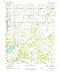
Editions of this 1972 Lake Holdenville Map
2 editions found
Other maps of this area

1896 · Coalgate
USGS Topo · 1:125,000

1899 · Coalgate
USGS Topo · 1:125,000

1900 · Wewoka
USGS Topo · 1:125,000

1900 · Coalgate
USGS Topo · 1:125,000

1954 · Oklahoma City
USGS Topo · 1:250,000

1957 · Ardmore
USGS Topo · 1:250,000

1957 · Oklahoma City
USGS Topo · 1:250,000

1963 · Ardmore
USGS Topo · 1:250,000

1963 · Oklahoma City
USGS Topo · 1:250,000

1967 · Calvin East
USGS Topo · 1:24,000