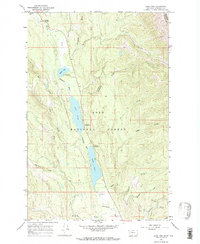
1965 Map of Lake Inez
USGS Topo · Published 1968About this map
Lolo National Forest encompasses this stretch of the Clearwater River valley during the mid-1960s, a landscape defined by a chain of glacial lakes and active timber-related industry. The presence of a sawmill near the southern shore of Lake Inez and a Gravel Pit north of Lake Alva highlights the era's reliance on local resource extraction. Recreational development is evident through established lakeside sites, including the Lake Inez Campground, Lake Alva Campground, and Rainy Lake Campground.
Find a feature on this map
28 named features on this map. Tap any name to fly to it.
Don’t see what you’re looking for? This feature index may not catch every label — zoom into the map to look around manually.
Map Details
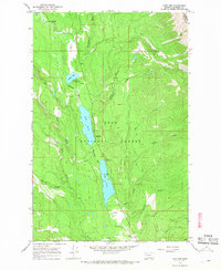
Editions of this 1965 Lake Inez Map
2 editions found
Other maps of this area

1902 · Ovando
USGS Topo · 1:125,000

1905 · Ovando
USGS Topo · 1:125,000

1921 · Elbow Lake
USGS Topo · 1:125,000

1955 · Choteau
USGS Topo · 1:250,000

1957 · Choteau
USGS Topo · 1:250,000

1958 · Choteau
USGS Topo · 1:250,000

1962 · Choteau
USGS Topo · 1:250,000

1965 · Upper Jocko Lake
USGS Topo · 1:24,000

1965 · Holland Lake
USGS Topo · 1:24,000

1965 · Seeley Lake West
USGS Topo · 1:24,000