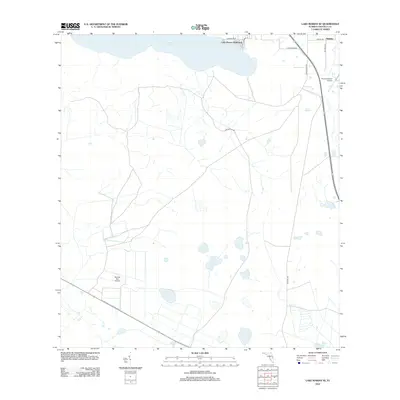
2012 Map of Lake Marian SE
USGS Topo · Published 2012About this map
The waters of Lake Marian define the northern boundary of this central Florida landscape, providing a focus for local development like Lake Marian Highlands. To the northeast, the settlement of Whittier sits at a crossroads, marking a pocket of habitation amidst a region defined by expansive open tracts and specialized aviation hubs. Small private airfields, including Flying S Ranch Airport and Blanket Bay Airport, reflect the area's rural character and the logistical needs of large ranch holdings. The transport network is a mix of established routes like Grant Bass Rd and more primitive paths such as Peavine Trl, illustrating the transition from residential lakeside clusters to the working agricultural interior of Osceola County in the early 2010s.
Find a feature on this map
12 named features on this map. Tap any name to fly to it.
Don’t see what you’re looking for? This feature index may not catch every label — zoom into the map to look around manually.
Map Details
Editions of this 2012 Lake Marian SE Map
This is the sole edition of this map. No revisions or reprints were ever made.
Other maps of this area

1952 · Fort Kissimmee NW
USGS Topo · 1:24,000

1953 · Lake Marian NW
USGS Topo · 1:24,000

1953 · Fort Kissimmee NE
USGS Topo · 1:24,000

1953 · Lake Marian SE
USGS Topo · 1:24,000

1953 · Fort Drum NW
USGS Topo · 1:24,000

1953 · Kenansville SW
USGS Topo · 1:24,000

1953 · Lake Marian SW
USGS Topo · 1:24,000

1953 · Kenansville
USGS Topo · 1:24,000

1953 · Lake Marian NE
USGS Topo · 1:24,000

1956 · Fort Pierce
USGS Topo · 1:250,000