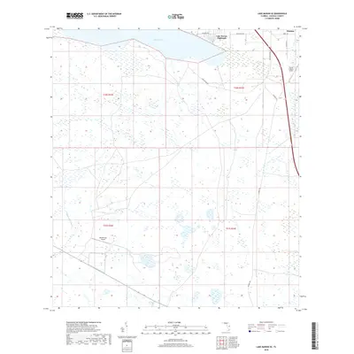
2018 Map of Lake Marian SE
USGS Topo · Published 2018About this map
Whittier and the residential clusters of Lake Marian Highlands occupy the northeastern corner of this landscape, where the waters of Lake Marian define the northern boundary. The terrain to the south and west is primarily open country, marked by seasonal drainage patterns like Blanket Bay Slough and an extensive network of rural paths, including the long stretch of Peavine Trl. This area reflects a quiet interior Florida character where aviation and ranching intersect, evidenced by the private strips at Blanket Bay Airport and Flying S Ranch Airport. The map is structured by the Public Land Survey System, showing several townships including t30s r32e, providing a clear grid for property research and land use study in Osceola County.
Find a feature on this map
16 named features on this map. Tap any name to fly to it.
Don’t see what you’re looking for? This feature index may not catch every label — zoom into the map to look around manually.
Map Details
Editions of this 2018 Lake Marian SE Map
This is the sole edition of this map. No revisions or reprints were ever made.
Other maps of this area

1952 · Fort Kissimmee NW
USGS Topo · 1:24,000

1953 · Lake Marian NW
USGS Topo · 1:24,000

1953 · Fort Kissimmee NE
USGS Topo · 1:24,000

1953 · Lake Marian SE
USGS Topo · 1:24,000

1953 · Fort Drum NW
USGS Topo · 1:24,000

1953 · Kenansville SW
USGS Topo · 1:24,000

1953 · Lake Marian SW
USGS Topo · 1:24,000

1953 · Kenansville
USGS Topo · 1:24,000

1953 · Lake Marian NE
USGS Topo · 1:24,000

1956 · Fort Pierce
USGS Topo · 1:250,000