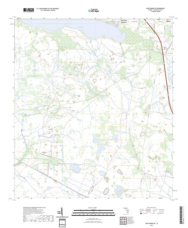
2024 Map of Lake Marian SE
USGS Topo · Published 2024About this map
Lake Marian defines the northern reaches of this central Florida landscape, where the residential community of Lake Marian Highlands sits along the shoreline. This contemporary survey captures a region where conservation efforts and private ranching interests intersect, notably through the fragmented tracts of the Everglades Headwaters National Wildlife Refuge and Conservation Area. To the east, the settlement of Whittier marks the edge of the sheet near the intersection of several local routes. The terrain is characterized by a complex network of wetlands and drainage patterns, including Blanket Bay Slough and numerous unnamed ponds. Aviation infrastructure is visible through small local strips like the Flying S Ranch Airport and Blanket Bay Airport, while local movement follows established paths like Peavine Trl and Lake Marian Rd.
Find a feature on this map
17 named features on this map. Tap any name to fly to it.
Don’t see what you’re looking for? This feature index may not catch every label — zoom into the map to look around manually.
Map Details
Editions of this 2024 Lake Marian SE Map
This is the sole edition of this map. No revisions or reprints were ever made.
Other maps of this area

1952 · Fort Kissimmee NW
USGS Topo · 1:24,000

1953 · Lake Marian NW
USGS Topo · 1:24,000

1953 · Fort Kissimmee NE
USGS Topo · 1:24,000

1953 · Lake Marian SE
USGS Topo · 1:24,000

1953 · Fort Drum NW
USGS Topo · 1:24,000

1953 · Kenansville SW
USGS Topo · 1:24,000

1953 · Lake Marian SW
USGS Topo · 1:24,000

1953 · Kenansville
USGS Topo · 1:24,000

1953 · Lake Marian NE
USGS Topo · 1:24,000

1956 · Fort Pierce
USGS Topo · 1:250,000