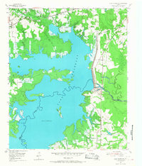
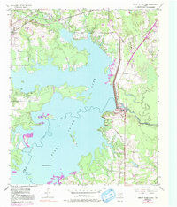
1954 Map of Lake Texarkana
USGS Topo · Published 1968About this map
Lake Texarkana dominates this landscape, created by the massive Texarkana Dam and its associated Spillway across the Sulphur River. The map documents the area during a period of transition, showing the newly flooded reservoir at a normal pool elevation of 225 feet, with Bells Island rising from the waters. Along the northern shores, the settlement of Redwater sits adjacent to the St Louis Southwestern railroad line, serving as a focal point for local transportation and community life.
Find a feature on this map
21 named features on this map. Tap any name to fly to it.
Don’t see what you’re looking for? This feature index may not catch every label — zoom into the map to look around manually.
Map Details
Editions of this 1954 Lake Texarkana Map
6 editions found

Other maps of this area

1907 · Atlanta
USGS Topo · 1:62,500

1909 · New Boston
USGS Topo · 1:62,500

1909 · Texarkana
USGS Topo · 1:62,500

1910 · Linden
USGS Topo · 1:62,500

1910 · Atlanta
USGS Topo · 1:62,500

1953 · Texarkana
USGS Topo · 1:250,000

1954 · Texarkana
USGS Topo · 1:24,000

1954 · Domino
USGS Topo · 1:24,000

1954 · Leary
USGS Topo · 1:24,000

1954 · Hooks
USGS Topo · 1:24,000