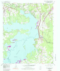
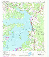
1954 Map of Wright Patman Lake
USGS Topo · Published 1983About this map
Wright Patman Lake dominates the center of this landscape at the border of Bowie and Cass Counties, representing a significant mid-century modification of the Sulphur River drainage. The massive Wright Patman Dam and its adjacent Water Intake Tower regulate the reservoir, which submerged portions of the river valley while leaving higher elevations like Bells Island as prominent features. To the northwest, the town of Redwater sits along the St Louis Southwestern Railroad, serving as a focal point for inland settlement away from the new shoreline.
Find a feature on this map
17 named features on this map. Tap any name to fly to it.
Don’t see what you’re looking for? This feature index may not catch every label — zoom into the map to look around manually.
Map Details
Editions of this 1954 Wright Patman Lake Map
6 editions found

Other maps of this area

1907 · Atlanta
USGS Topo · 1:62,500

1909 · New Boston
USGS Topo · 1:62,500

1909 · Texarkana
USGS Topo · 1:62,500

1910 · Linden
USGS Topo · 1:62,500

1910 · Atlanta
USGS Topo · 1:62,500

1953 · Texarkana
USGS Topo · 1:250,000

1954 · Texarkana
USGS Topo · 1:24,000

1954 · Domino
USGS Topo · 1:24,000

1954 · Leary
USGS Topo · 1:24,000

1954 · Hooks
USGS Topo · 1:24,000