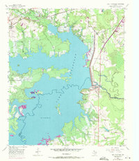
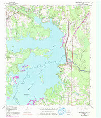
1954 Map of Lake Texarkana
USGS Topo · Published 1971About this map
Lake Texarkana dominates this landscape, its waters controlled by the substantial Texarkana Dam and flowing into the Sulphur River. The map captures a moment of transition for the region, with purple photorevisions from 1970 showing significant new road infrastructure marked as Under Construction along the Bowie and Cass county lines. At the time of the original survey, the St Louis Southwestern Railroad Grade remained a prominent topographical feature near Redwater, while local landmarks like Opossum Trot Church and Holloway Cem anchor the rural community life of the mid-20th century.
Find a feature on this map
19 named features on this map. Tap any name to fly to it.
Don’t see what you’re looking for? This feature index may not catch every label — zoom into the map to look around manually.
Map Details
Editions of this 1954 Lake Texarkana Map
6 editions found

Other maps of this area

1907 · Atlanta
USGS Topo · 1:62,500

1909 · New Boston
USGS Topo · 1:62,500

1909 · Texarkana
USGS Topo · 1:62,500

1910 · Linden
USGS Topo · 1:62,500

1910 · Atlanta
USGS Topo · 1:62,500

1953 · Texarkana
USGS Topo · 1:250,000

1954 · Texarkana
USGS Topo · 1:24,000

1954 · Domino
USGS Topo · 1:24,000

1954 · Leary
USGS Topo · 1:24,000

1954 · Hooks
USGS Topo · 1:24,000