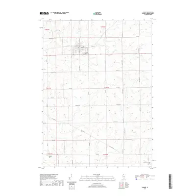
2018 Map of Lanark
USGS Topo · Published 2018About this map
Lanark serves as the primary hub of this Carroll County landscape, defined by a grid of agricultural land and wandering creek systems. The town is situated at the intersection of Carroll Rd and N Broad St, with the Lanark City Cem marking its southern edge. This 2018 survey reveals a modern rural structure built upon long-established travel routes, such as Telegraph Rd, which cuts diagonally across the southern townships. The drainage patterns of Rock Cr, Straddle Cr, and Otter Cr dictate the topography, creating natural breaks in the rectangular field sections. Outside the main settlement, the land is dotted with historic burial grounds including Union Cem and the Chadwick Methodist Cem, providing essential points of reference for genealogists and local historians tracing family lineages in these rural townships.
Find a feature on this map
33 named features on this map. Tap any name to fly to it.
Don’t see what you’re looking for? This feature index may not catch every label — zoom into the map to look around manually.
Map Details
Editions of this 2018 Lanark Map
This is the sole edition of this map. No revisions or reprints were ever made.
Other maps of this area

1930 · Woodsung
USGS Topo · 1:48,000

1934 · Morrison
USGS Topo · 1:48,000

1940 · Morrison
USGS Topo · 1:62,500

1942 · Mt Carroll
USGS Topo · 1:62,500

1942 · Forreston
USGS Topo · 1:62,500

1944 · Mt Carroll
USGS Topo · 1:62,500

1945 · Forreston
USGS Topo · 1:62,500

1946 · Sterling
USGS Topo · 1:62,500

1948 · Sterling
USGS Topo · 1:62,500

1954 · Rockford
USGS Topo · 1:250,000