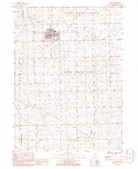
1985 Map of Lanark
USGS Topo · Published 1986About this map
Lanark serves as the central hub of this northern Illinois agricultural landscape, where the rectilinear grid of country roads reflects the well-established township boundaries of Cherry Grove-Shannon, Freedom, and Rock Creek-Lima. The terrain is defined by the drainage patterns of Straddle Creek to the north and the winding course of Rock Creek and Otter Creek to the south.
Find a feature on this map
12 named features on this map. Tap any name to fly to it.
Don’t see what you’re looking for? This feature index may not catch every label — zoom into the map to look around manually.
Map Details
Editions of this 1985 Lanark Map
This is the sole edition of this map. No revisions or reprints were ever made.
Other maps of this area

1930 · Woodsung
USGS Topo · 1:48,000

1934 · Morrison
USGS Topo · 1:48,000

1940 · Morrison
USGS Topo · 1:62,500

1942 · Mt Carroll
USGS Topo · 1:62,500

1942 · Forreston
USGS Topo · 1:62,500

1944 · Mt Carroll
USGS Topo · 1:62,500

1945 · Forreston
USGS Topo · 1:62,500

1946 · Sterling
USGS Topo · 1:62,500

1948 · Sterling
USGS Topo · 1:62,500

1954 · Rockford
USGS Topo · 1:250,000