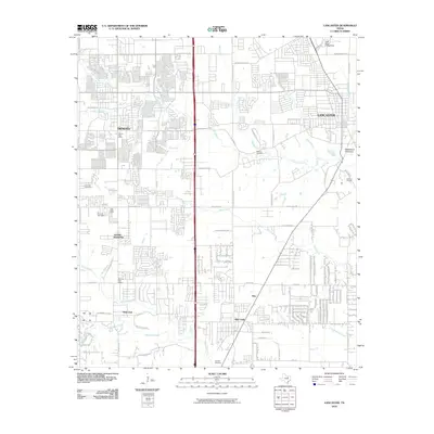
2010 Map of Lancaster
USGS Topo · Published 2010About this map
DeSoto, Lancaster, and Red Oak anchor this landscape south of Dallas, where residential expansion increasingly surrounds older rural markers and family burial grounds. The drainage of Tenmile Creek and Bear Creek dictates much of the area's geography, with the Cedar Valley College Dam positioned near the northern edge. Longstanding community sites such as Vincent Cemetery and Rawlins Cemetery provide essential touchpoints for local genealogists, while Edgewood Cemetery sits near the winding course of Hells Branch. The map captures a moment of transition where large-scale suburban platting meets established landmarks like Carroll Air Park and the rural roads connecting Glenn Heights to Oak Leaf. This era is defined by the convergence of modern logistics at the DeSoto Post Office and the persistent natural corridors of Red Oak Creek and Brushy Creek.
Find a feature on this map
74 named features on this map. Tap any name to fly to it.
Don’t see what you’re looking for? This feature index may not catch every label — zoom into the map to look around manually.
Map Details
Editions of this 2010 Lancaster Map
This is the sole edition of this map. No revisions or reprints were ever made.
Other maps of this area

1891 · Dallas
USGS Topo · 1:125,000

1893 · Dallas
USGS Topo · 1:125,000

1954 · Dallas
USGS Topo · 1:250,000

1956 · Ennis
USGS Topo · 1:62,500

1958 · Dallas
USGS Topo · 1:250,000

1958 · Hutchins
USGS Topo · 1:24,000

1958 · Oak Cliff
USGS Topo · 1:24,000

1959 · Lancaster
USGS Topo · 1:24,000

1959 · Cedar Hill
USGS Topo · 1:24,000

1959 · Ferris
USGS Topo · 1:24,000