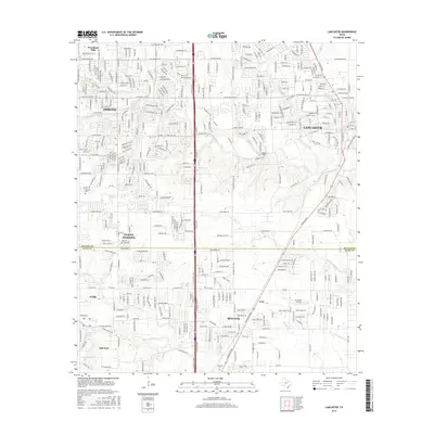
2016 Map of Lancaster
USGS Topo · Published 2016About this map
Lancaster and Red Oak anchor this suburban corridor south of Dallas, where the landscape is defined by the crossing of major thoroughfares and the winding paths of local tributaries. The map documents the dense residential expansion surrounding DeSoto and Glenn Heights, contrasting with the more open lands near Oak Leaf and Ovilla. Local history is anchored by the Rawlins Cem and Red Oak Cem, which remain as markers of the area's earlier rural character amid modern development. Numerous waterways, including Tenmile Cr, Bear Cr, and Red-Oak Cr, carve through the terrain, dictating the placement of roads like W Belt Line Rd and W Bear Creek Rd. The border between Dallas Co and Ellis Co bisects the area, illustrating how municipal growth has unified these once-distinct North Texas communities.
Find a feature on this map
41 named features on this map. Tap any name to fly to it.
Don’t see what you’re looking for? This feature index may not catch every label — zoom into the map to look around manually.
Map Details
Editions of this 2016 Lancaster Map
This is the sole edition of this map. No revisions or reprints were ever made.
Other maps of this area

1891 · Dallas
USGS Topo · 1:125,000

1893 · Dallas
USGS Topo · 1:125,000

1954 · Dallas
USGS Topo · 1:250,000

1956 · Ennis
USGS Topo · 1:62,500

1958 · Dallas
USGS Topo · 1:250,000

1958 · Hutchins
USGS Topo · 1:24,000

1958 · Oak Cliff
USGS Topo · 1:24,000

1959 · Lancaster
USGS Topo · 1:24,000

1959 · Cedar Hill
USGS Topo · 1:24,000

1959 · Ferris
USGS Topo · 1:24,000