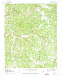
1972 Map of Landis
USGS Topo · Published 1973About this map
Ozark National Forest covers much of this northern Arkansas landscape, where the terrain is defined by the winding paths of Big Creek and Roasting Ear Creek. The settlement of Landis serves as a local hub, accompanied by numerous family and community landmarks such as Landis Cem, Freeman Cem, and Wallace Cem. These small burial grounds and rural houses of worship, including Round Mountain Ch and Bethlehem Ch, highlight the dispersed nature of mountain communities in Searcy County during the early 1970s.
Find a feature on this map
32 named features on this map. Tap any name to fly to it.
Don’t see what you’re looking for? This feature index may not catch every label — zoom into the map to look around manually.
Map Details
Editions of this 1972 Landis Map
2 editions found
Other maps of this area

1890 · Mountain Home
USGS Topo · 1:125,000

1891 · Mountain Home
USGS Topo · 1:125,000

1892 · Marshall
USGS Topo · 1:125,000

1892 · Mountain View
USGS Topo · 1:125,000

1893 · Yellville
USGS Topo · 1:125,000

1894 · Mountain View
USGS Topo · 1:125,000

1894 · Mountain Home
USGS Topo · 1:125,000

1894 · Marshall
USGS Topo · 1:125,000

1901 · Marshall
USGS Topo · 1:125,000

1903 · Yellville
USGS Topo · 1:125,000