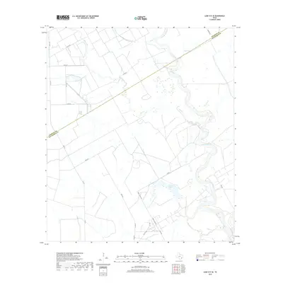
2019 Map of Lane City SE
USGS Topo · Published 2019About this map
The Colorado River meanders across this low-lying coastal plain along the boundary of Wharton and Matagorda Counties, shaping a landscape defined by significant drainage and irrigation infrastructure. The river's winding course is mirrored by several oxbow features and basins, including Neal Lake and Jennings Lake. Human modification for agriculture is evident through the presence of the Pierce Canal, which cuts across the terrain to manage water resources for the surrounding fields. The road network, including Poole Rd and Tommy Letulle Rd, provides access to the agricultural parcels that dominate the geography. Several seasonal and perennial waterways like Blue Creek and Dry Cr feed into the river system, illustrating the complex hydrology required to support this region's rural economy. This survey documents the area just before the turn of the decade, capturing the modern alignment of rural routes like FM 2175 Hwy and various county roads.
Find a feature on this map
23 named features on this map. Tap any name to fly to it.
Don’t see what you’re looking for? This feature index may not catch every label — zoom into the map to look around manually.
Map Details
Editions of this 2019 Lane City SE Map
This is the sole edition of this map. No revisions or reprints were ever made.
Other maps of this area

1950 · Houston
USGS Topo · 1:250,000

1951 · Bay City
USGS Topo · 1:250,000

1951 · Danevang
USGS Topo · 1:24,000

1952 · Lane City SE
USGS Topo · 1:24,000

1952 · Pledger
USGS Topo · 1:24,000

1952 · Bay City
USGS Topo · 1:24,000

1952 · Markham
USGS Topo · 1:24,000

1952 · Lane City
USGS Topo · 1:24,000

1952 · Van Vleck
USGS Topo · 1:24,000

1952 · Midfield
USGS Topo · 1:24,000