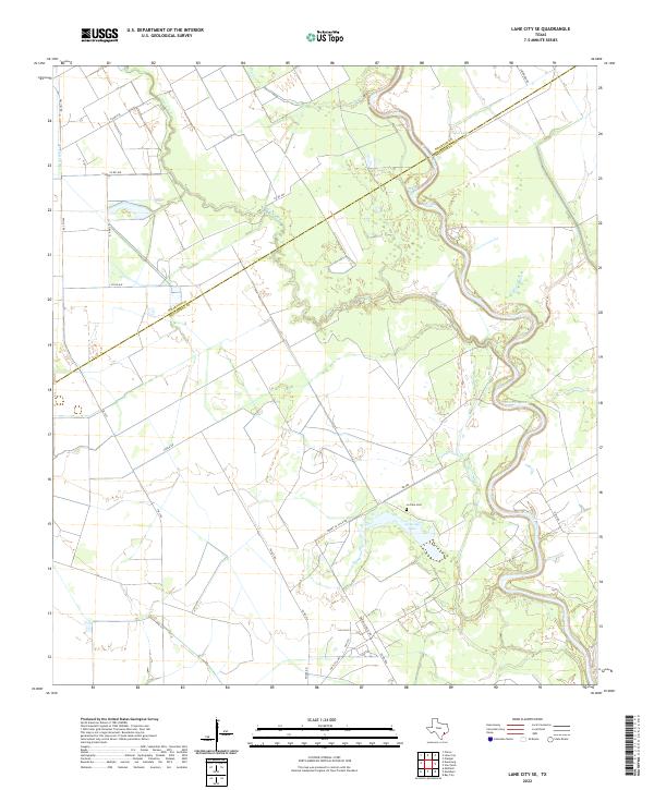
2022 Map of Lane City SE
USGS Topo · Published 2022About this map
The Colorado River defines the winding geography of this coastal plain boundary between Wharton and Matagorda counties. This landscape is shaped by water management and irrigation, most notably the Pierce Canal and drainage networks like Blue Creek and Dry Cr. The presence of the Le Tulle Cem and Jennings Lake near the junction of Tommy Le Tulle Rd and Poole Rd suggests a landscape tied to family-named landholdings and established agricultural estates. The survey reveals the persistent influence of large-scale water features on the local road network, where rural routes like Ohio Rd and Co Rd 446 navigate around the oxbows and wetlands of the river valley.
Find a feature on this map
25 named features on this map. Tap any name to fly to it.
Don’t see what you’re looking for? This feature index may not catch every label — zoom into the map to look around manually.
Map Details
Editions of this 2022 Lane City SE Map
This is the sole edition of this map. No revisions or reprints were ever made.
Other maps of this area

1950 · Houston
USGS Topo · 1:250,000

1951 · Bay City
USGS Topo · 1:250,000

1951 · Danevang
USGS Topo · 1:24,000

1952 · Lane City SE
USGS Topo · 1:24,000

1952 · Pledger
USGS Topo · 1:24,000

1952 · Bay City
USGS Topo · 1:24,000

1952 · Markham
USGS Topo · 1:24,000

1952 · Lane City
USGS Topo · 1:24,000

1952 · Van Vleck
USGS Topo · 1:24,000

1952 · Midfield
USGS Topo · 1:24,000