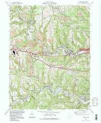
1994 Map of Lansing
USGS Topo · Published 1998About this map
High Ridge and the deep incisions of Wheeling Creek define this portion of Belmont County, where industrial history and rural topography meet. While the landscape is heavily marked by Strip Mines and modern commercial development like the Ohio Valley Mall Shopping Center, the map reveals a network of older settlements such as Barton, Blaine, and Neffs that grew alongside the Wheeling and Lake Erie and Baltimore and Ohio railroads.
Find a feature on this map
78 named features on this map. Tap any name to fly to it.
Don’t see what you’re looking for? This feature index may not catch every label — zoom into the map to look around manually.
Map Details
Editions of this 1994 Lansing Map
This is the sole edition of this map. No revisions or reprints were ever made.
Other maps of this area

1902 · Wheeling
USGS Topo · 1:62,500

1904 · Cameron
USGS Topo · 1:62,500

1905 · Clarington
USGS Topo · 1:62,500

1905 · St. Clairsville
USGS Topo · 1:62,500

1935 · Cameron
USGS Topo · 1:62,500

1935 · Clarington
USGS Topo · 1:62,500

1935 · Wheeling
USGS Topo · 1:62,500

1940 · Clarington
USGS Topo · 1:62,500

1942 · Cameron
USGS Topo · 1:62,500

1942 · Wheeling
USGS Topo · 1:62,500