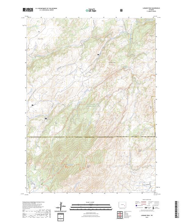
2023 Map of Laramie Peak
USGS Topo · Published 2023About this map
Friend Park serves as a lone named focal point in this high-altitude landscape within the Medicine Bow National Forest. The map documents the rugged interface of Converse County and Albany County, where the terrain is defined by the massive granite uplift of Laramie Peak. A complex network of watercourses, including Horseshoe Creek, Roaring Fork, and Cottonwood Creek, drains the slopes, illustrating the high-country drainage patterns of the Laramie Range. Trails such as the Harris Park Trl and Roaring Fork Creek Trl indicate the recreational and accessibility routes through this primitive area, which remains largely devoid of concentrated settlement outside of small campsites and remote forest roads.
Find a feature on this map
1 named feature on this map. Tap any name to fly to it.
Don’t see what you’re looking for? This feature index may not catch every label — zoom into the map to look around manually.
Map Details
Editions of this 2023 Laramie Peak Map
This is the sole edition of this map. No revisions or reprints were ever made.
Other maps of this area

1943 · Esterbrook
USGS Topo · 1:62,500

1945 · Esterbrook
USGS Topo · 1:62,500

1954 · Torrington
USGS Topo · 1:250,000

1958 · Torrington
USGS Topo · 1:250,000

1964 · Saddleback Mountain
USGS Topo · 1:24,000

1964 · Windy Peak
USGS Topo · 1:24,000

1968 · Cow Creek Mountain
USGS Topo · 1:24,000
1968 · Fletcher Park
USGS Topo · 1:24,000
1968 · South Mountain
USGS Topo · 1:24,000
1981 · Laramie Peak
USGS Topo · 1:100,000