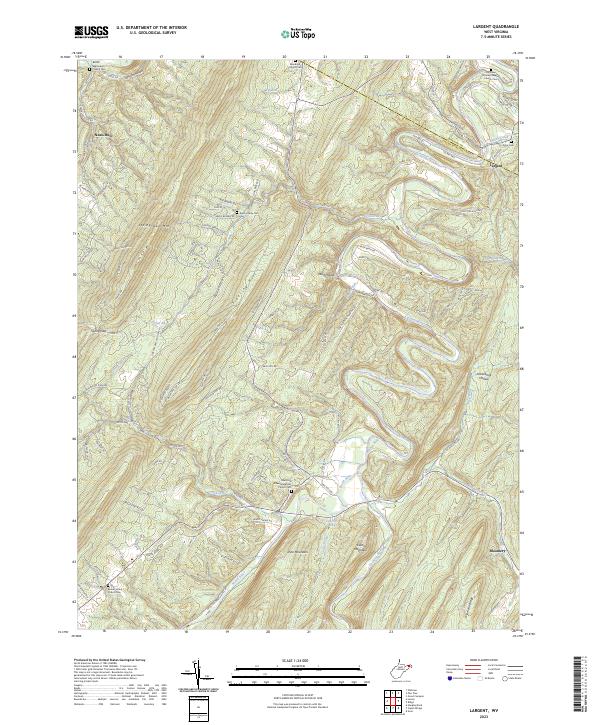
2023 Map of Largent
USGS Topo · Published 2023About this map
The Cacapon River carves a winding path through the borderlands of Hampshire and Morgan Counties, anchoring a landscape defined by sharp ridges and deep hollows. The settlement of Largent sits near the river's northern bend, while Bloomery occupies the southeastern corner of the quadrangle. This area is characterized by significant topographical features such as Sideling Hill, Spring Gap Mtn, and Castle Mountain, which dictate the local road network. Genealogists will find a high concentration of burial sites, including the Kerns Family Cem and numerous church-affiliated grounds like the Old Enon Primitive Baptist Church Cem. The presence of several distinct springs and runs, such as Linnie Hiett Spring and Falling Spring Run, indicates a water-rich environment despite the steep elevations of Diamond Ridge and Pine Mountain. The map detail follows the transition from river valleys to high gaps, tracing a network of county routes and forest trails that connect these isolated mountain communities.
Find a feature on this map
112 named features on this map. Tap any name to fly to it.
Don’t see what you’re looking for? This feature index may not catch every label — zoom into the map to look around manually.
Map Details
Editions of this 2023 Largent Map
This is the sole edition of this map. No revisions or reprints were ever made.
Other maps of this area

1891 · Romney
USGS Topo · 1:125,000

1894 · Winchester
USGS Topo · 1:125,000

1898 · Paw Paw
USGS Topo · 1:62,500

1899 · Flintstone
USGS Topo · 1:62,500

1900 · Pawpaw
USGS Topo · 1:62,500

1900 · Flintstone
USGS Topo · 1:62,500

1910 · Paw Paw
USGS Topo · 1:62,500

1916 · Capon Bridge
USGS Topo · 1:62,500

1921 · Hanging Rock
USGS Topo · 1:48,000

1923 · Capon Bridge
USGS Topo · 1:62,500