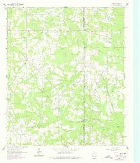
1962 Map of Latex
USGS Topo · Published 1978About this map
Latex sits at a unique tri-point where the borders of Texas, Louisiana, and Arkansas converge, anchoring a landscape defined by its rural infrastructure and early energy development. The presence of numerous Oil Well and Gas Well sites throughout the area reflects the industrial character of the region in the mid-20th century. Local life is centered around scattered settlements like Lotta and Jonesville, where the Jonesville Sch and several country churches, including Mt Zion Ch and Republican Ch, served the community.
Find a feature on this map
32 named features on this map. Tap any name to fly to it.
Don’t see what you’re looking for? This feature index may not catch every label — zoom into the map to look around manually.
Map Details
Editions of this 1962 Latex Map
Other maps of this area

1943 · Waskom
USGS Topo · 1:62,500

1944 · Caddo Lake
USGS Topo · 1:62,500

1945 · Waskom
USGS Topo · 1:62,500

1945 · Greenwood
USGS Topo · 1:62,500

1946 · Caddo Lake
USGS Topo · 1:62,500

1948 · Mooringsport
USGS Topo · 1:62,500

1955 · Shreveport
USGS Topo · 1:250,000

1955 · Mooringsport
USGS Topo · 1:62,500

1955 · Greenwood
USGS Topo · 1:62,500

1956 · Shreveport
USGS Topo · 1:250,000